1. Carta Catalana
Carta Catalana, 1450-1460. Estensi Digital Library, Biblioteca Estense Universitaria. Permission pending from the Ministry of Cultural Heritage and Activities, Italy.
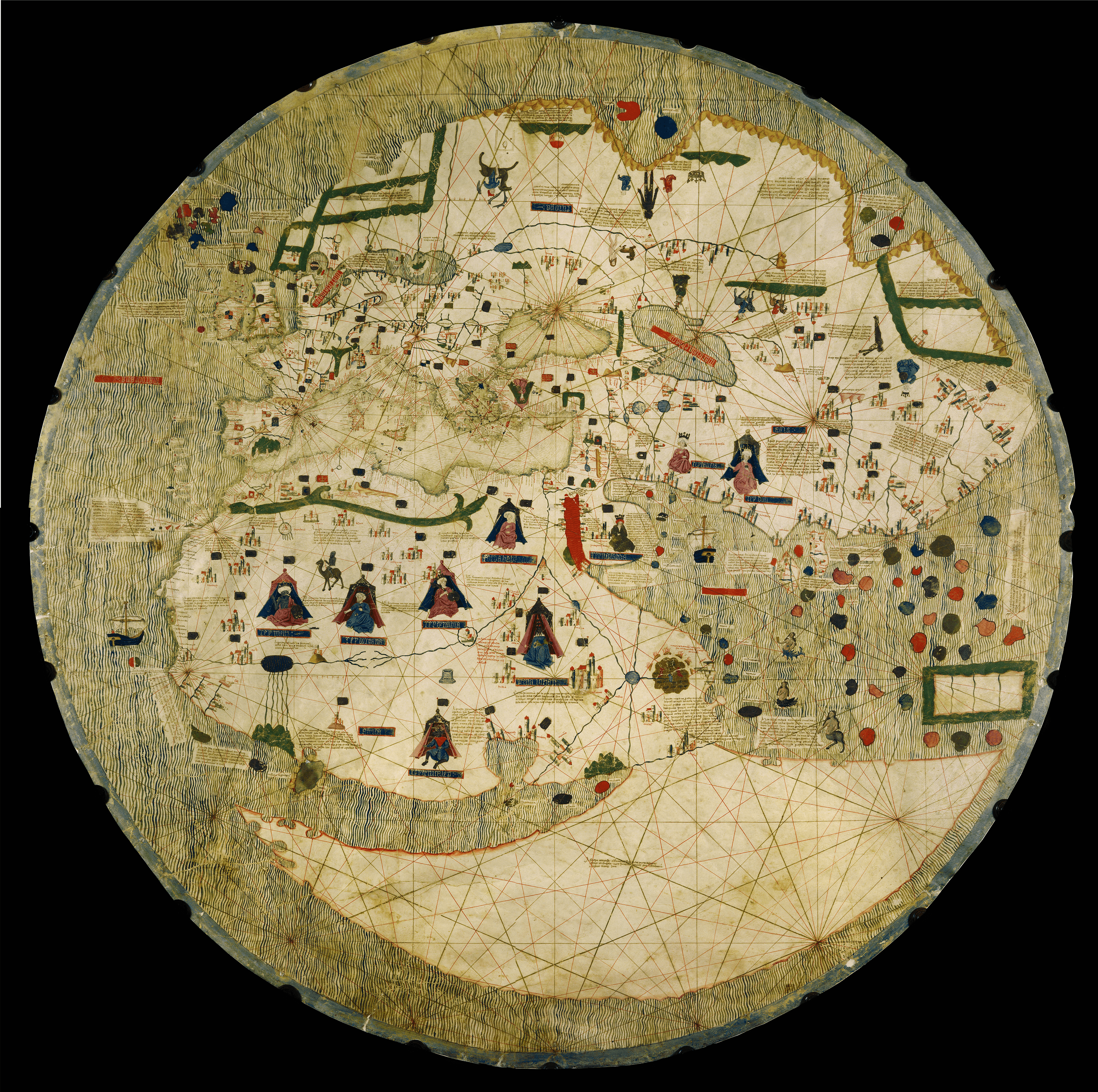
Created between 1450 and 1460 by an unknown Catalan chartmaker, this mappamundi shows the world as three continents surrounded by water. The web of lines, or rhumbs, correspond to the wind directions measured by a compass. Such lines appeared on charts and aided in navigation. This highly illuminated world chart was not intended to be taken to sea; rather it was a luxury item, intended for a prince or a wealthy merchant. In the East, the Indian Ocean is prominent and studded with islands, while in the West, the Atlantic Ocean is named Mar Ocleana (Ocean Sea). The Carta Catalana was part of the library of the Duke of Ferrara, and was described in an inventory dated 1488. To consult the map at the Estense Digital Library, click here.