4. Juan de la Cosa, Carta Universal, 1500
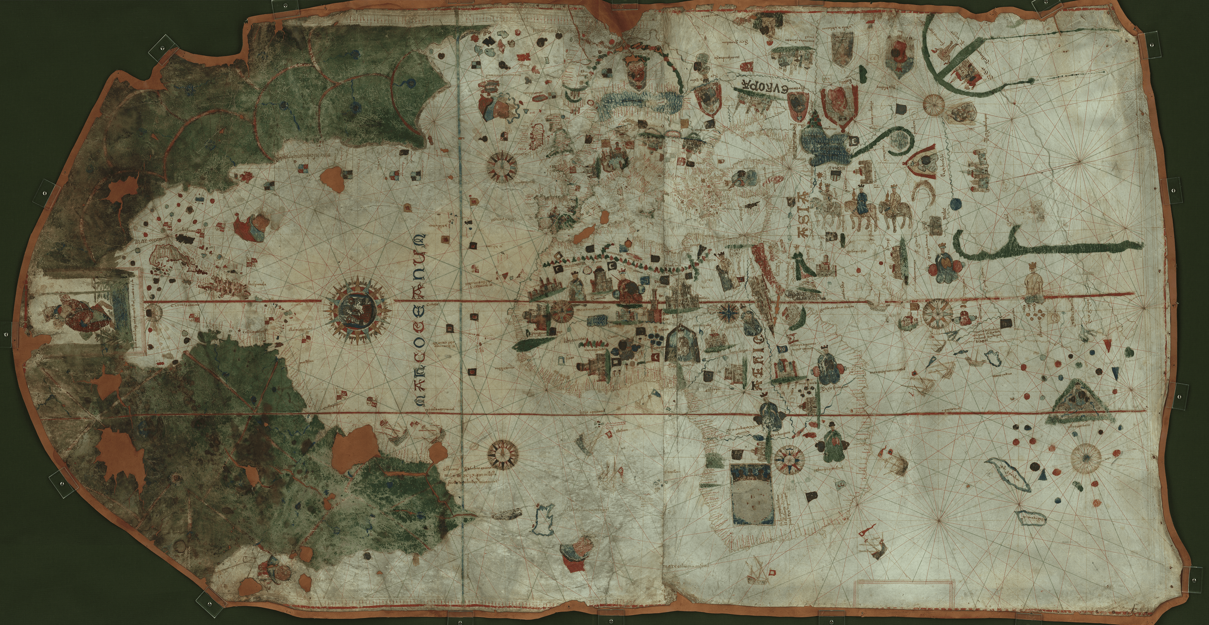
Juan de la Cosa, Carta Universal, Biblioteca Virtual del Ministerio de Defensa, Madrid.
Juan de la Cosa signed the oldest surviving world chart that shows an expansive Atlantic and a massive continental presence in the West soon after returning from his third transatlantic voyage in 1500. The Carta Universal was most likely intended for Bishop Juan Rodríguez de Fonseca, administrator of the Spanish Indies, or Ferdinand and Isabella. The world chart measures 93 × 183 cm (about 3 × 6 feet), and it is painted over two joined calfskins. La Cosa likely used Mediterranean charts for Europe and the Mediterranean Sea and the Black Sea, Portuguese charts for the coast of West Africa, and Ptolemaic maps for the Indian Ocean. The information for the Americas came from charts that no longer remain. La Cosa presents the Atlantic Ocean as a large body of water, and he labels it with its generic Latin name: Mare Oceanum (Ocean Sea). This name reappears in the Caribbean, where as compared to the enormous landmass painted in deep greens, the islands of Hispaniola and Cuba remain unpainted and their place names can be easily read. Other islands are also labeled. This area, the Spanish Indies, appears on the chart as known, in contrast to the mainlands that are deep green. To consult the world chart at the library of the Ministry of Defense, Madrid, click here.
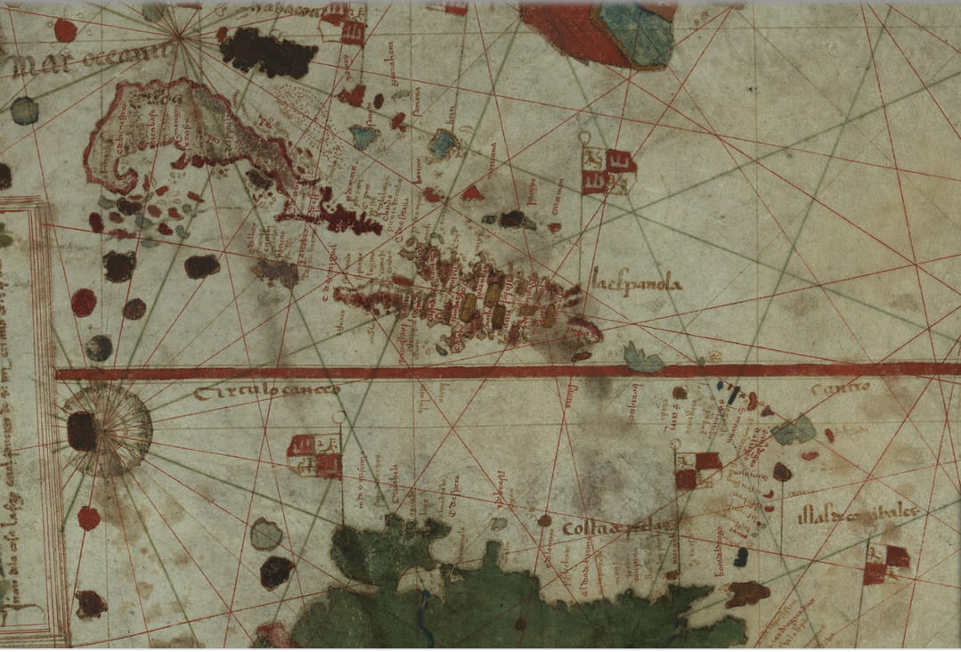
Detail, La Cosa, Carta Universal, Biblioteca Virtual del Ministerio de Defensa, Madrid.
The deep green extends to the mainlands to the North and South. Just south of the equator, ships are painted off the coast of the dark green mainland. The legend reads: “This cape was discovered in the year 1499 by Spain and the discoverer was Vicentinas,” which is a reference to Vicente Yáñez Pinzón. This is the region visited by La Cosa, Alonso de Ojeda, and Amerigo Vespucci on their 1499 voyage.
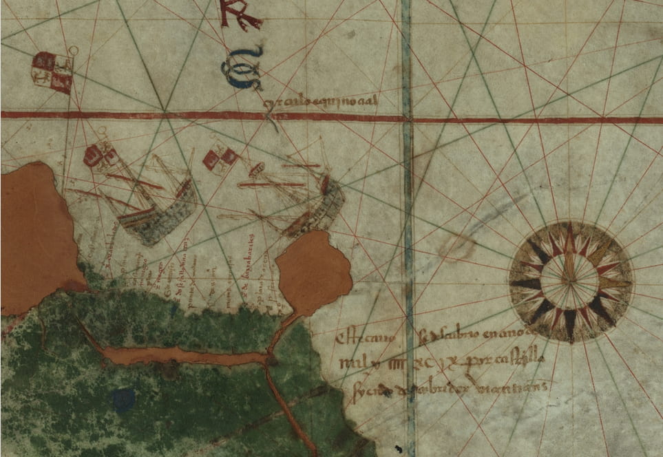
Detail, La Cosa, Carta Universal, Biblioteca Virtual del Ministerio de Defensa, Madrid.