5. Portolan Chart (King-Hamy), ca. 1502
HM 45. The Huntington Library, San Marino, California.
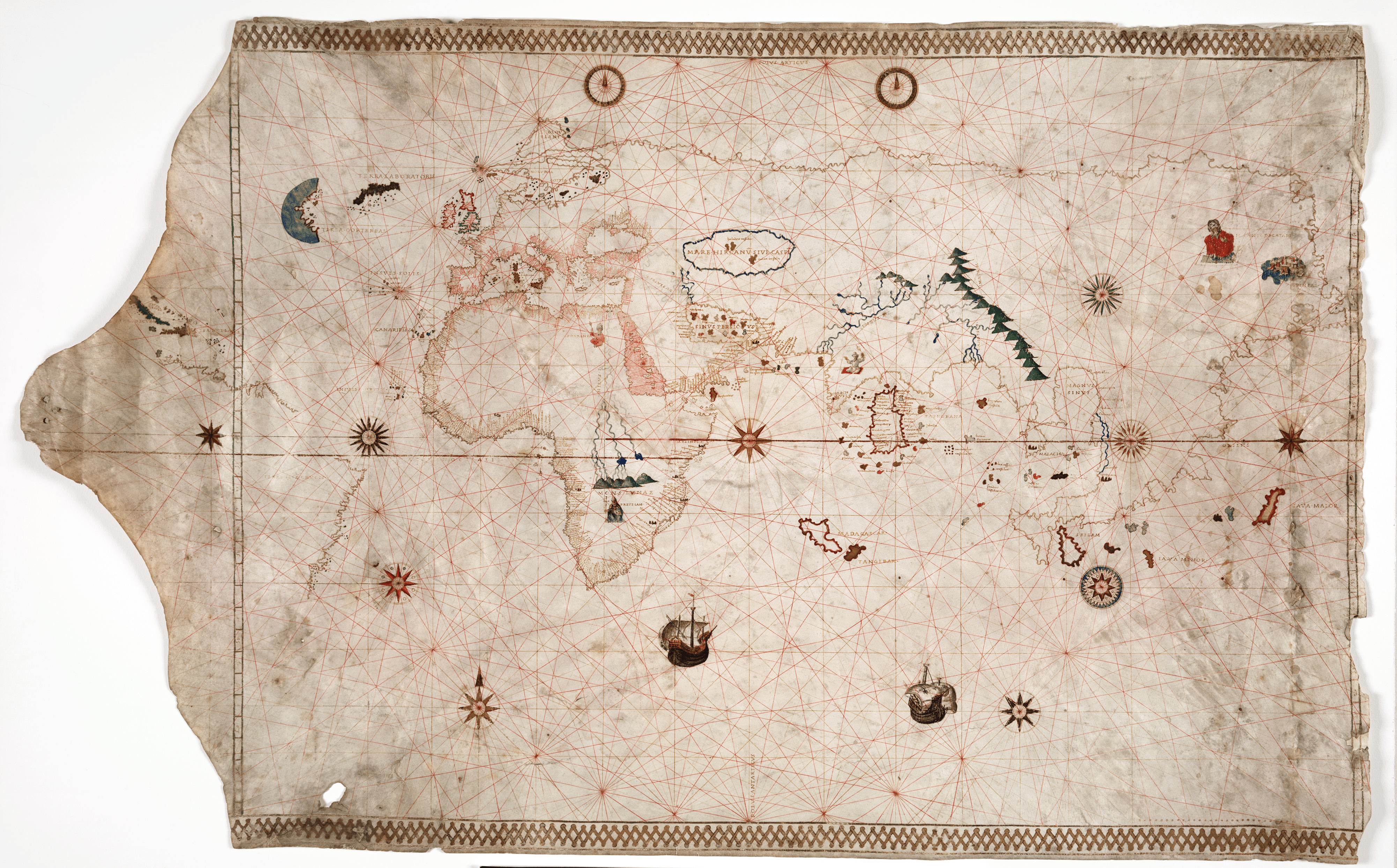
Although centered in the Indian Ocean, this world chart nevertheless gives significant space to the Atlantic. The Portolan Chart, also known as the Portolan Chart (King-Hamy), dates to approximately 1502. Measuring 585 × 942 mm (about 2 × 3 feet), the world chart was originally nailed to a rod. The outline of the coast of Brazil can be seen, as well as the northern coastline of South America (there is a substantial break between them) and the islands of Cuba and Isabella (Hispaniola) are labeled in the Caribbean. In contrast to the few toponyms provided for the western Atlantic, the eastern Atlantic, both in the north and south, is heavily labeled. The chart resides in the Huntington Library, San Marino, California. For the catalog entry of this chart at the Huntington Library, click here, and to study the map in high resolution, click here.
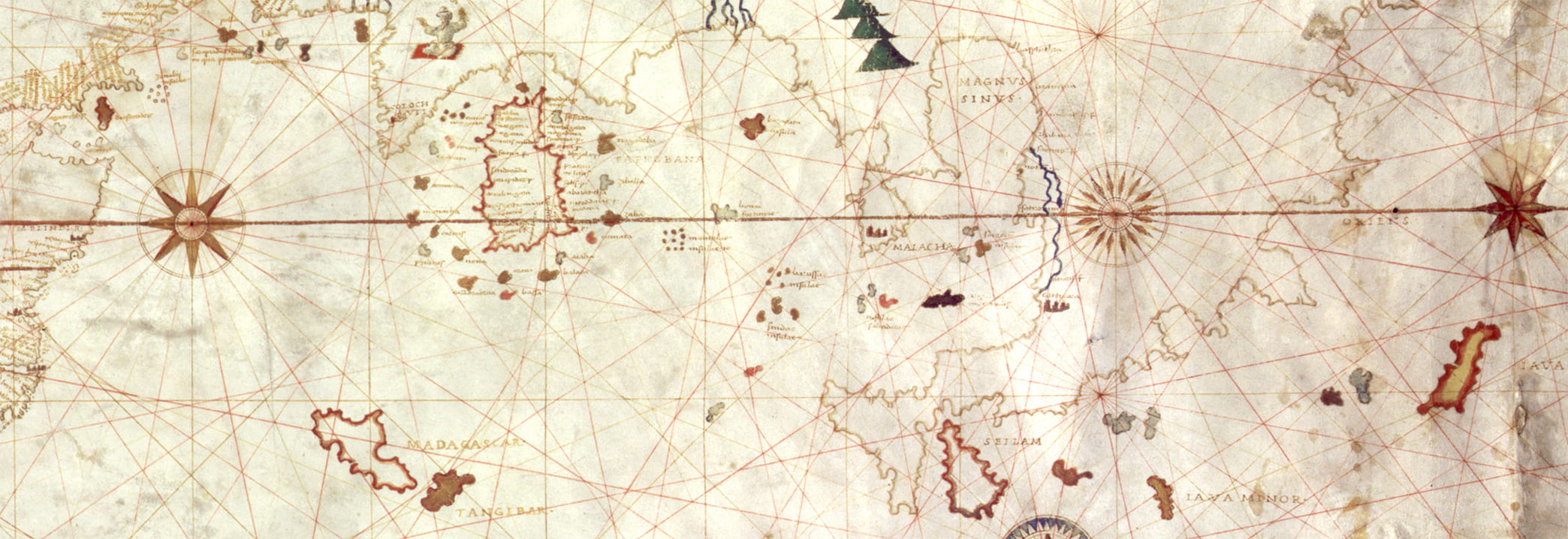
The world chart has been attributed to Amerigo Vespucci, and it portrays the Atlantic and Indian Oceans much as he describes them in his letters. The coastline in the western Atlantic corresponds to the long voyage he described along the eastern coast of South America, but the heart of the world chart is the Indian Ocean–where Vespucci thought he was headed on two of his voyages. The mapping of Africa follows the Portugese charts (see Plate 6, Carta del Cantino), but the Indian Ocean is presented using a Ptolemaic view of Asia. The Magnus Sinus appears to the East of India, corresponding to the modern Bay of Bengal. The peninsula, with the city of Cattigara marked, extends into the Indian Ocean. Following Ptolemy’s twelfth map of Asia, the island of Taprobane is placed centrally in the Indian Ocean, and it is surrounded by smaller islands. The equator runs through its southern region in the same place as on Ptolemy’s map.
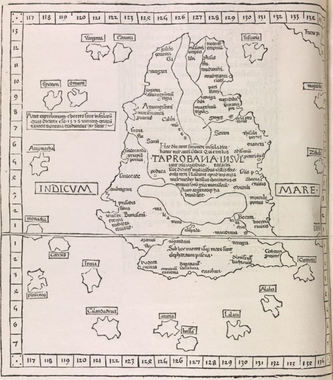
Tabula Asia XII, in Ptolemy Cosmographia. Ulm: 1482. Library of Congress.