7. Nicolay de Caverio, Planisphère nautique, 1506
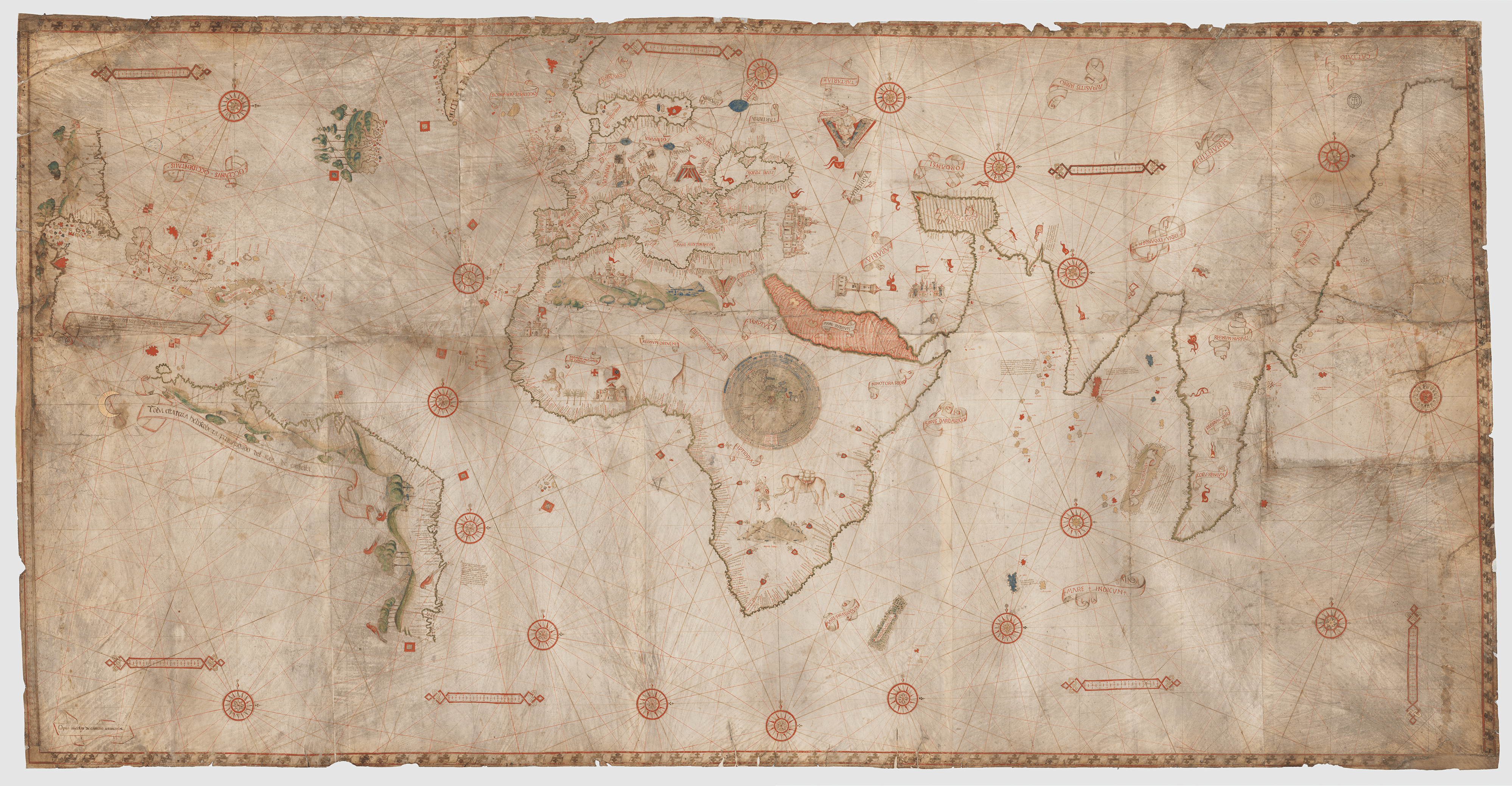
Bibliothèque nationale de France.
The Atlantic is a major oceanic space on Planisphère nautique by Nicolay Caverio of Genoa. Yet the central focus of the chart is Africa and the interconnected Atlantic and Indian Oceans. The large central compass rose in Africa and the sub-roses placed in the Atlantic and Indian Oceans emphasize the possibilities of maritime trade between Europe, Africa, and India. Many similarities to Carta del Cantino (Plate 6) suggests that Caverio copied Carta del Cantino (or that both world charts shared a now lost prototype). For example, Carta del Cantino measures 105 × 220 cm (about 3 ½ × 7 feet) and is composed of six skins; Caverio’s world chart measures 115 × 225 cm (about 3 ¾ × 7 ⅓ feet) and is composed of ten. Both world charts have virtually identical legends for Brazil and Calicut. Further evidence suggesting that Caverio copied Cantino’s chart is that both display a similar error: the unthinkable omission of the Nile River. Still, the two world charts are not identical. Caverio added geographic information that is not found on Carta del Cantino, such as more place names along the coast of Brazil, and his choice of illuminations does not completely replicate those on Carta del Cantino. To consult the world chart in the Bibliothèque nationale de France, click here.