Fig. 1.1. The Atlantic on T-O Mappaemundi
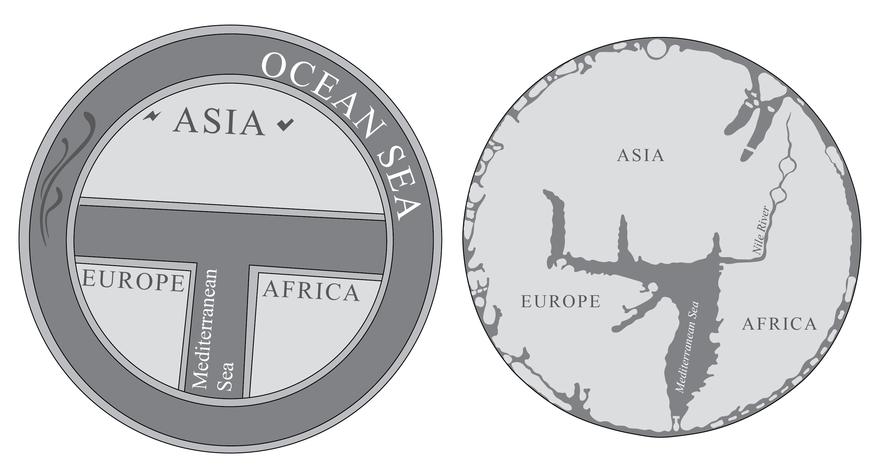
Redrawn from mappamundi, ca. 603, in Isidore de Seville, Etymologiae, 1472 (left), and the Hereford Mappa Mundi, ca. 1300 (right).
In medieval Europe, maps of the world, known as mappaemundi, paid little attention to the Atlantic. In part this was due to a common structure that underlies many mappaemundi, which is known as the T-O schema. The T-O presents the world as a circle: the O is formed by the oceans that surround the known world, while the T is the axis created by the Mediterranean Sea and rivers such as the Nile or the Don. The T divides up the known world into three continents: Africa, Asia, and Europa. Even though the Atlantic forms a part of the world’s oceans, it is not given any significance. On the left in fig. 1.1 appears the mappamundi from Isidore de Seville’s Etymologies (603, CE) as traced from a digital facsimile taken from the edition of Seville’s Etymologies printed in Augsburg in 1472. On the right, appears the traced coastlines and the Nile River from a digital facsimile of the Hereford Mappa Mundi. All other information was omitted or greatly simplified in order to reveal the underlying T-O structure. Paired in this way, the figure reveals how the T-O schema used to create each mappamundi minimized the Atlantic.