Fig. 1.4. The Atlantic on Transitional Mappaemundi
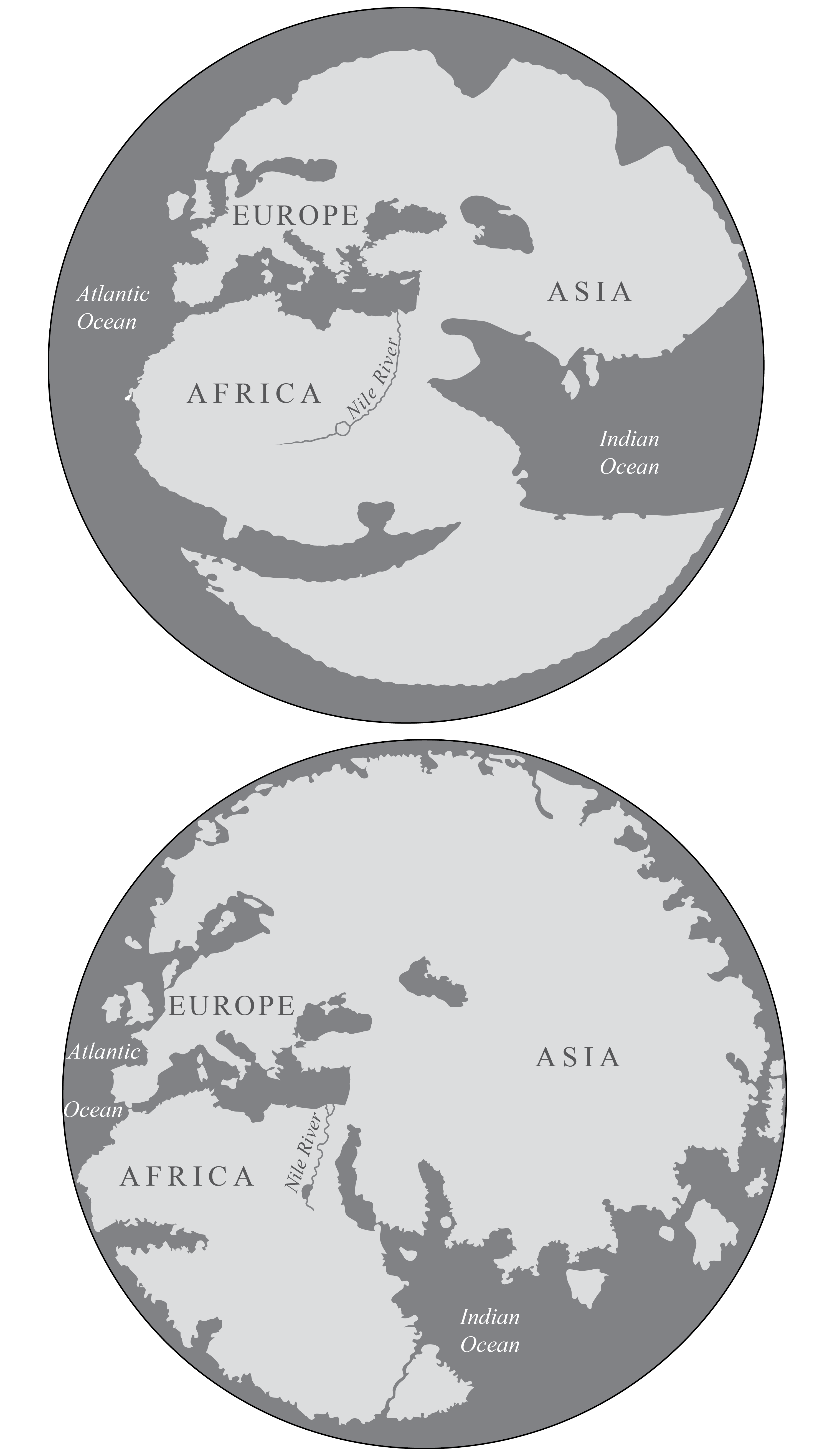
Redrawn from Carta Catalana, ca. 1450-60, Estensi Digital Library, Biblioteca Estense Universitaria, Modena, Italy (top), and Il mappamondo di Fra Mauro, 1450, Biblioteca Nazionale Marciana, Venice (bottom).
On two fifteenth century mappaemundi–the anonymous Carta Catalana and Fra Mauro’s mappamundi–the Atlantic Ocean joins the Indian Ocean as an important body of water. On each mappamundi the Atlantic Ocean connects not only to the Mediterranean but also to the Indian Ocean. Each mappamundi contains elements of medieval mappaemundi–such as the T-O layout–and the incorporation of detailed information drawn from classical, biblical, and medieval sources. However, Fra Mauro and the anonymous catalan chartmaker also include detailed information from the chartmaking tradition to enhance their depiction of the Atlantic. Fra Mauro even labels part of it Oceanus Athlanticus, see detail below.
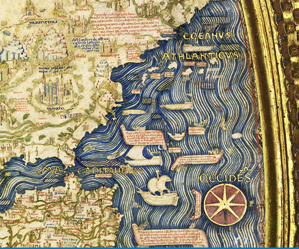
Detail from Fra Mauro, Il mappamondo di Fra Mauro, 1450.
This detail, which has South at the top and West on the right, shows the Iberian peninsula, the Straits of Gibralter, and North Africa. Note Fra Mauro’s use of the label Oceanus Athlanticus off the coast of Northwest Africa. Also note how Fra Mauro visualizes currents, suggesting the easy access to the Atlantic from the Mediterranean, which is further suggested by the two boats sailing from the Atlantic to the Mediterranean.
To create fig. 1.4, the coastlines of each mappamundi were traced from digital facsimiles.