Fig. 1.5 Atlantic Details on a Catalan World Chart
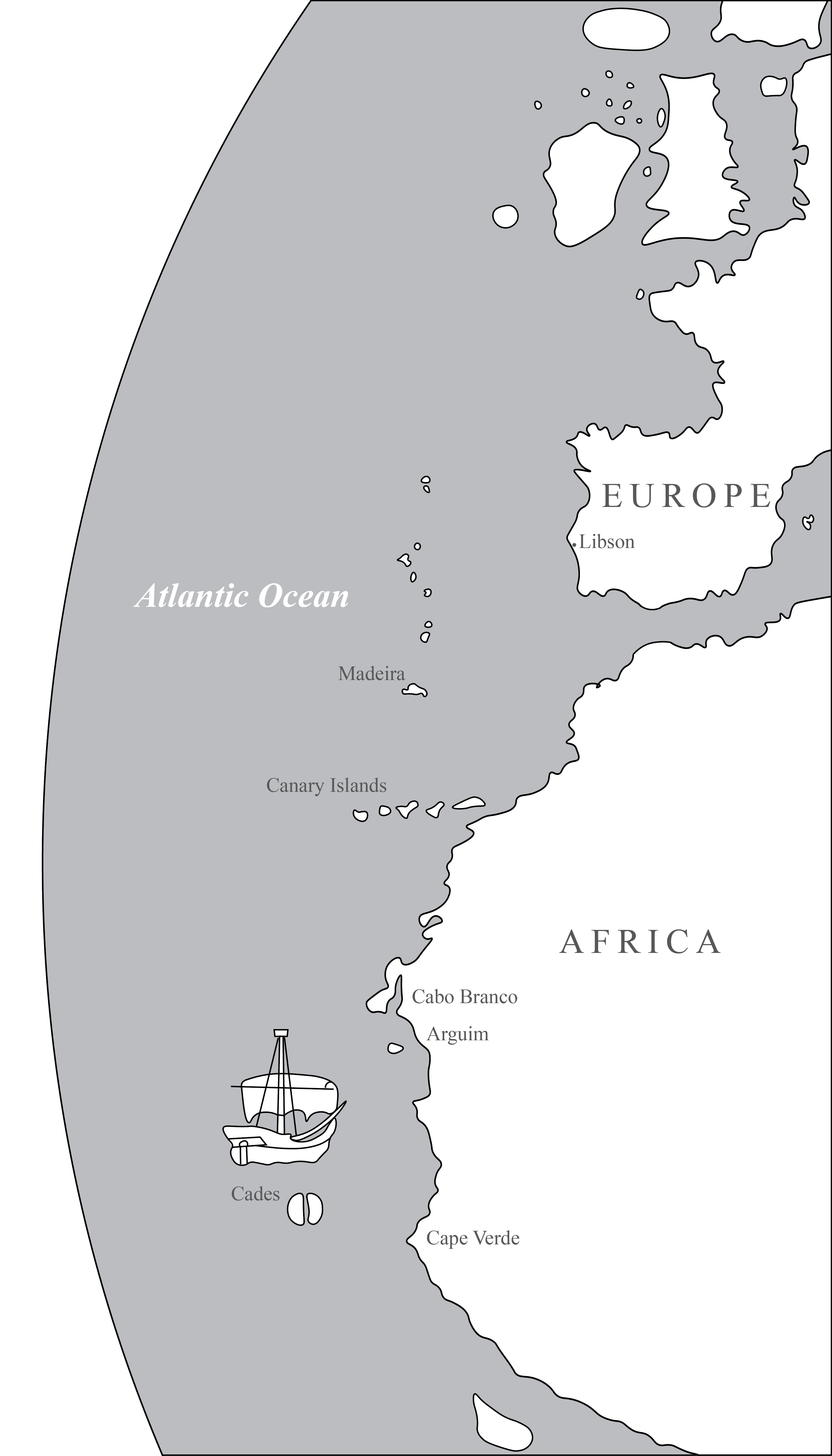
Redrawn from Carta Catalana, ca. 1450-60, Estensi Digital Library, Biblioteca Estense Universitaria, Modena, Italy.
On Carta Catalana the chartmaker differentiates between what is known and what remains unknown about the Atlantic Ocean. Carefully located and labeled are Atlantic archipelagoes: the Azores, Madeira, and the Canary Islands. The island of Arguim appears just south of Cabo Branco, and it is a new piece of information about the Atlantic, for it refers to an early trading post established in West Africa by the Portuguese. Arguim was constructed in 1448; and by the 1450s, regular commerce in textiles and grains exchanged for slaves and gold was taking place there. Two stylized islands named Cades appear below the sailboat. The legend reads: “Cades Island here Hercules placed two columns.” Cades refers to the island of Gades (Cadiz) in the Atlantic just beyond the Straits of Gibraltar, and the columns refer to the Pillars of Hercules. By placing the island and the pillars here, the chartmaker marks the extent of knowledge of the Atlantic Ocean. South of Cades, the chartmaker offers no more information, suggesting that beyond lies the unknown ocean as well as the unexplored lands of Africa. This detail from the Carta Catalana emphasizes how much of the Atlantic the chartmaker included–obviously deeming it important–even though on the mappamundi the Atlantic still remains peripheral.
To create figure 1.5, the eastern Atlantic coastlines and the Atlantic islands are traced from a digital facsimile of the Carta Catalana. The boat heading for the Portuguese trading post of Arquim and the islands labeled Cades are also traced directly from the map.