Fig. 1.6. The Atlantic on a Ptolemaic Mappamundi
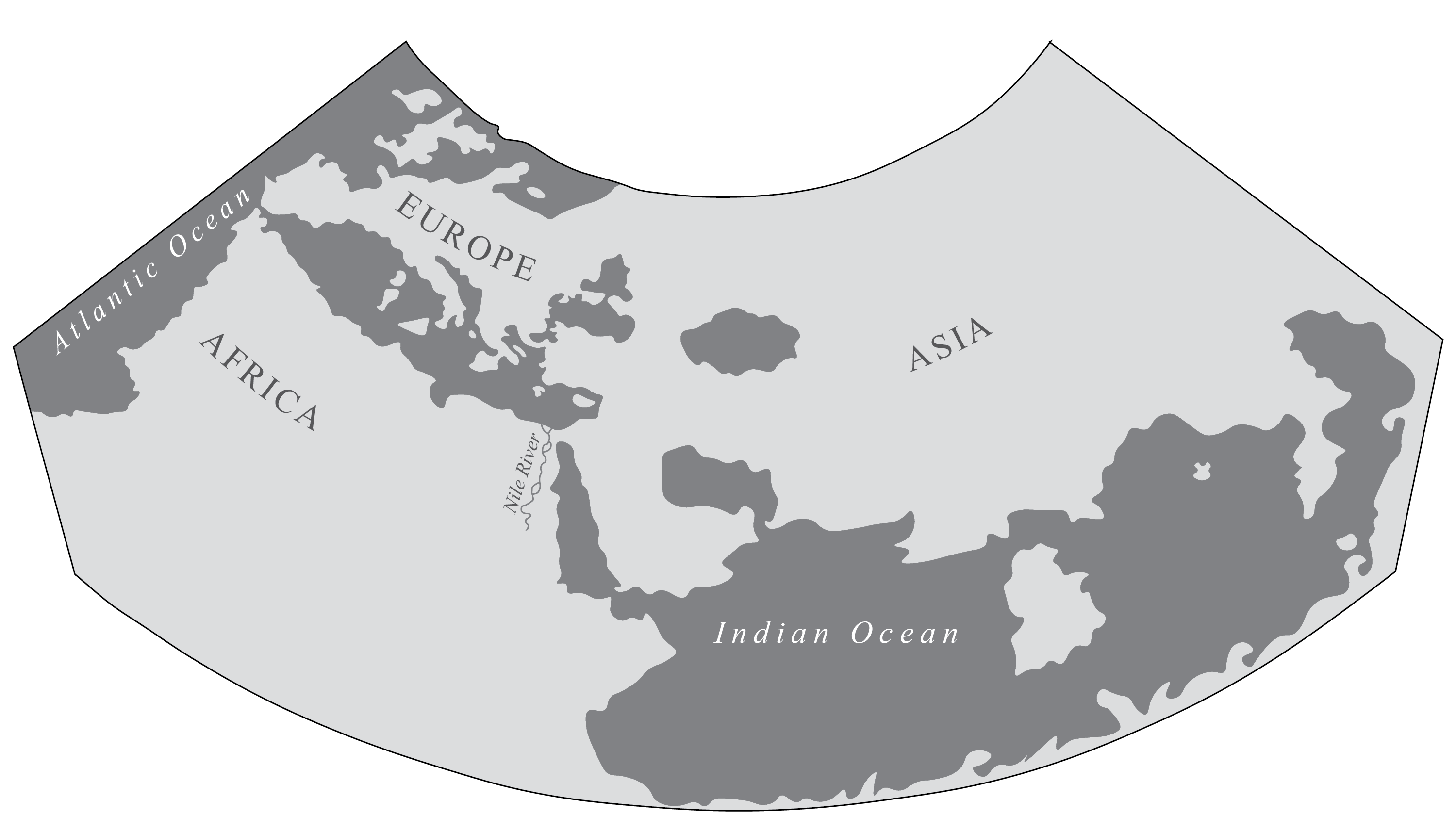
Redrawn from Nicolò Germano, Planisfero, in Ptolemy, Cosmographia, 1466, Estensi Digital Library, Biblioteca Estense Universitaria, Modena, Italy.
The Atlantic remains very much peripheral to the world on Ptolemaic mappaemundi. Ptolemy provided instructions for making world maps, and cosmographers and artists followed them as they created editions of Ptolemy’s Geography, known as Cosmographia or Geographia in Renaissance Europe. Nicolò Germano created this world map in an illuminated manuscript for Borso d’ Este, the Duke of Ferrara in 1466. He followed Ptolemy’s instructions on how to make the world map, beginning with the projection. Ptolemy introduced two projections that he believed best depicted the spherical world on a flat surface. The first was a conic projection where the meridians are straight lines and the parallels are concentric arcs.
Nicolò Germano used this conic projection for his mappamundi. The resulting world map shows Europe, Africa, and Asia as the three continents of the known world The Atlantic Ocean is mapped as far north as England, Scotland, and Ireland, and along the coast of West Africa in the south. Africa can not be circumnavigated, and the Indian Ocean is presented as the most important ocean in the world. By tracing the coastlines of the world from a digital facsimile of Nicolò Germano’s Planisfero this figure emphasizes Nicolò Germano’s representation of the Atlantic, which appears as a slim ocean bordering the west.
See Plate 3 for the map in color. For access to all of the maps created by Nicolò Germano for this edition, see Ptolemy, Cosmographia, Estensi Digital Library, Biblioteca Estense Universitaria, Modena, Italy.