Fig. 3.3. Main Compass Rose, Carta del Cantino, 1502
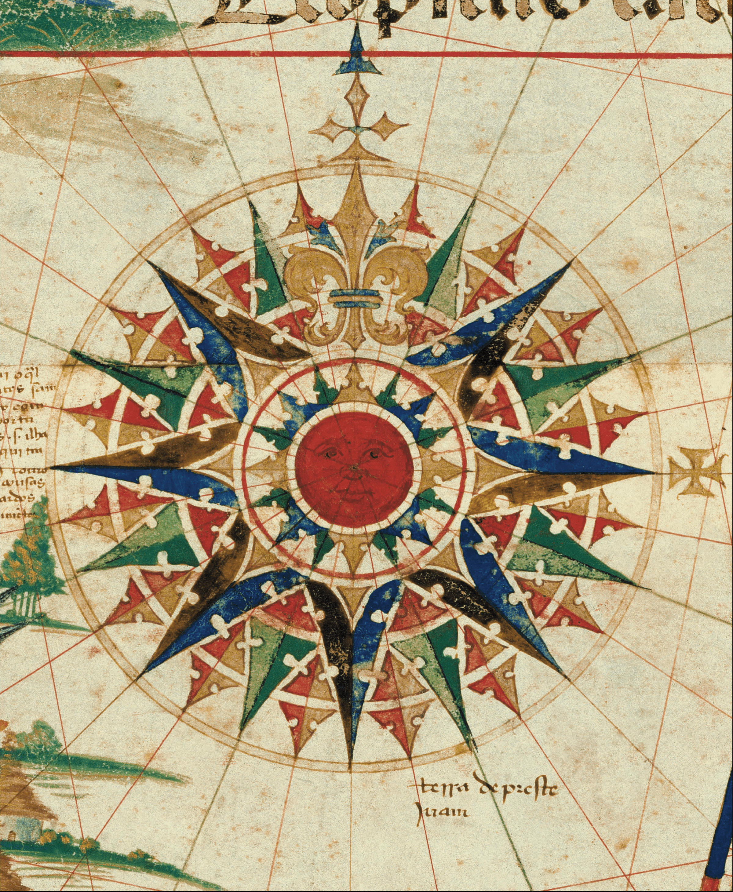
Detail from Carta del Cantino, Estensi Digital Library, Biblioteca Estense Universitaria, Modena. Permission pending from the Ministry of Cultural Heritage and Activities, Italy.
The chartmaker of Carta del Cantino placed an elaborate compass rose in the center of the world chart. This central rose is the most intricate compass rose on any extant Portuguese nautical chart of its time. In its center is a round orange sun with a face. The sun’s nose is a point from which the chartmaker drew thirty-two lines to represent the compass directions. These thirty-two lines bisect a series of circles, each of which is a part of an elaborate compass.
Beyond the sun with its white circular frame, sixteen triangles point to the “winds” of the mariner’s compass. The four cardinal points (North, East, South, West) are golden triangles; the four ordinal points (Northeast, Southeast, Southwest, Northwest) are blue triangles; the quarter winds (North-Northeast; East-Northeast; East-Southeast; South-Southeast; South-southwest; West-Southwest; West-Northwest; North-Northwest) are green triangles. Each of these triangles has a scoop cut out of the sides, transforming the triangle into an arrow that points to its direction.
After a red and white ring, golden triangles point to seven of the eight main winds (N NE E SE S SW W NW), and an elaborate golden fleur-de-lis marks north. The seven golden triangles are embedded into long, thin isosceles triangles, painted in blue and black, with double scoops cut out of their two sides.
Subsequent rings add the eight half winds, shown as green triangles, and the sixteen winds painted red and orange.
On top of the last ring is a pointer in gold and blue that marks North; 45° around the circle a golden cross on the outside that marks East. All of this intricate geometry of lines, triangles, and circles shows off the cartographer’s skill with geometry and design.
Chartmakers also made the nautical compasses taken to sea, and perhaps this same design lay inside a mariner’s compass taken to sea. Below is an example of a mariner’s compass from the early eighteenth century:
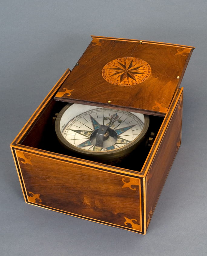
Agulha de Marear (MM.04618), Museu de Marinha, Lisbon, Portugal.