Fig. 3.6. An Illustrated Chart
Redrawn from Mecia de Viladestes, Carte marine de l’océan Atlantique Nord-Est, de la mer Méditerranée, de la mer Noire, de la mer Rouge, d’une partie de la mer Caspienne, du golfe Persique et de la mer Baltique, 1413, Bibliothèque nacionale de France.
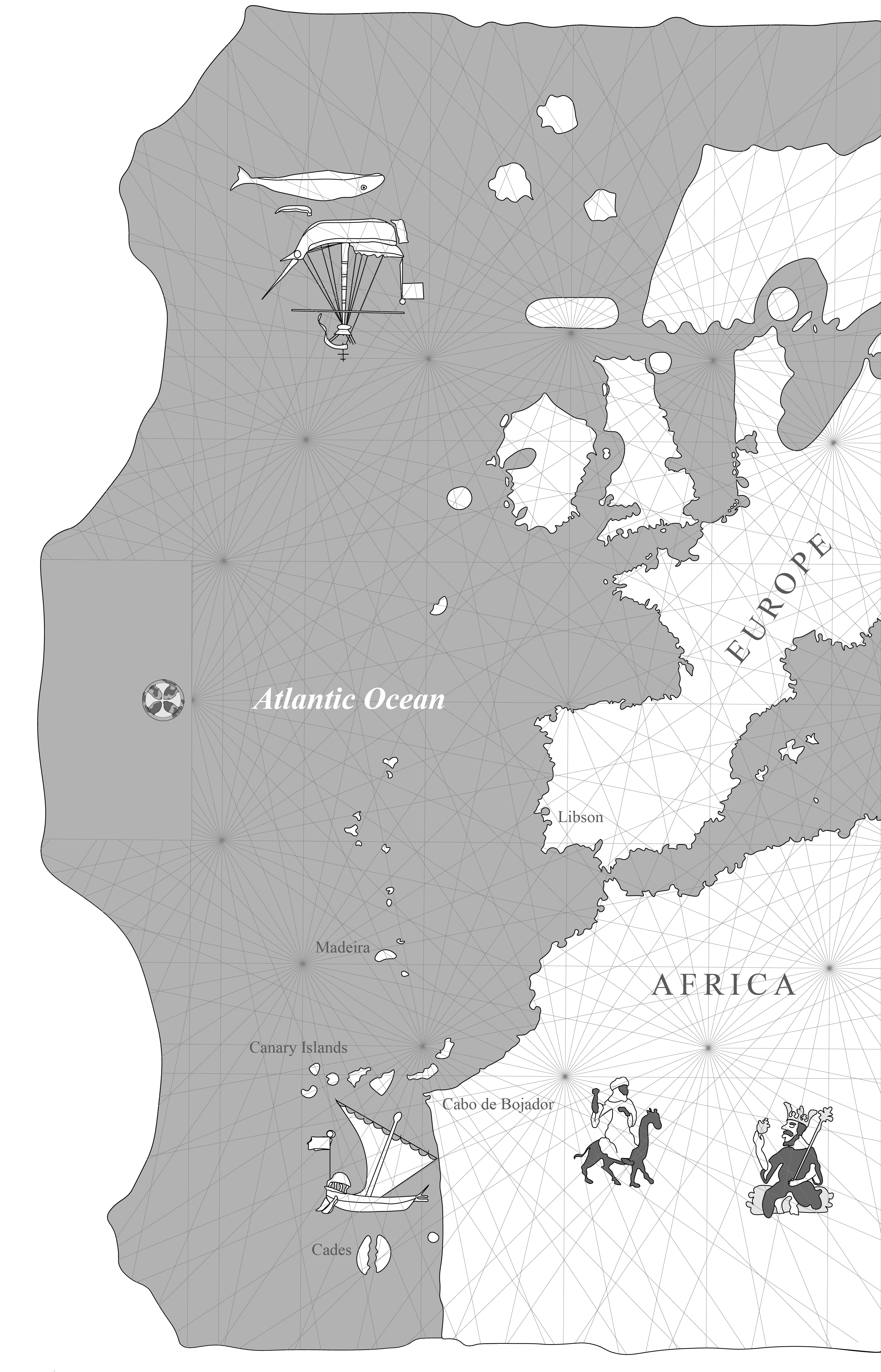
The Atlantic appears with illuminations that underscore its accessibility to mariners on the highly illuminated chart of 1413 by the Mallorcan chartmaker Mecia de Viladestes. Off the coast of West Africa sails a boat, repeating the imagery found on the earlier Atlas de cartes marines. In the far north Atlantic, sailors armed with a harpoon approach a whale from a small boat that has left a larger sailing vessel. Viladestes labeled the Atlantic as “Mar Hocceano” (Ocean Sea), and he shows it extending from West Africa to the Norwegian Sea. He included place names (toponyms) along the West African coastline to Cap de Buyeter (Cape Bojador) while in Africa appear familiar images: a man mounted on a camel, and the king of Meli (Mali) holding a golden nugget. Below Cape Bojador, the coastline continues, but Viladestes entered no more toponyms. Two stylized islands, named Gades, mirror each other, and mark the end of the known Atlantic.In figure 3.6, we traced coastlines and several of the illuminations from a digital facsimile of Viladestes’ chart. The rhumb lines were computer generated from original points on the chart.