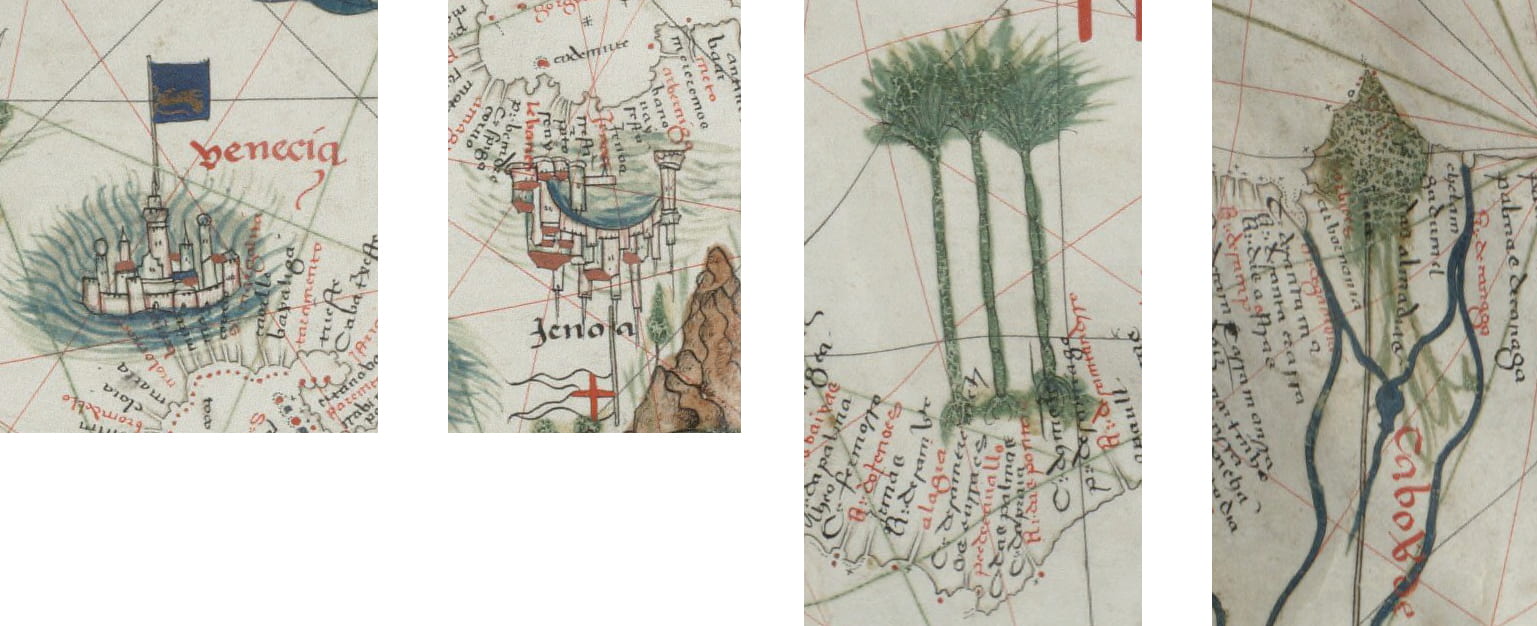
Fig. 3.9. A Cityscape and a Landscape on Aguiar’s Portolan Chart, 1492
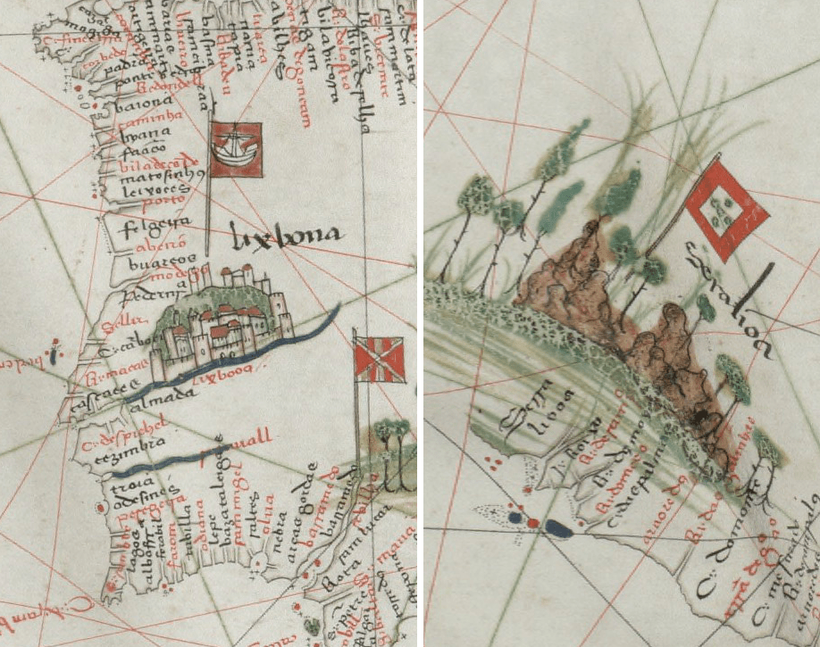
Details from Aguiar, Portolan Chart of the Mediterranean Sea, Beinecke Rare Book and Manuscript Library, Yale University, New Haven.
The chart signed by Jorge de Aguiar in 1492 has carefully painted cityscapes and landscapes as part of its illuminations. For an illuminated chart, a patron might have requested or suggested designs to the chartmaker, and if a chartmaker employed an illuminator, so too might have the artist. On the Portolan Chart of the Mediterranean Sea (see details above and below) the illuminations are painted so as to be suggestive of their actual locations. For example, Lisbon appears as a city on a hill along a river (see above left), and in fact, Lisbon is often described as a city on seven hills along the Tejo River. Venice is depicted as floating in a watery space highlighting its canals while Genoa curves around its distinctive bay (see below). Aguiar matched the landscape illuminations to locations as well. The landscape of Sierra Leone (above right) appears as a rocky coastline with trees. More stylized landscapes include the three palms used to represent Cabo Tres Palmas (Cape of the Three Palms) and green for Cabo Verde (Green Cape).