Fig. 4.1. Eastern and Western Hemispheres, 1507
Detail from Martin Waldseemüller, Universalis Cosmographia, 1507, Geography and Map Division, Library of Congress, Washington, DC.
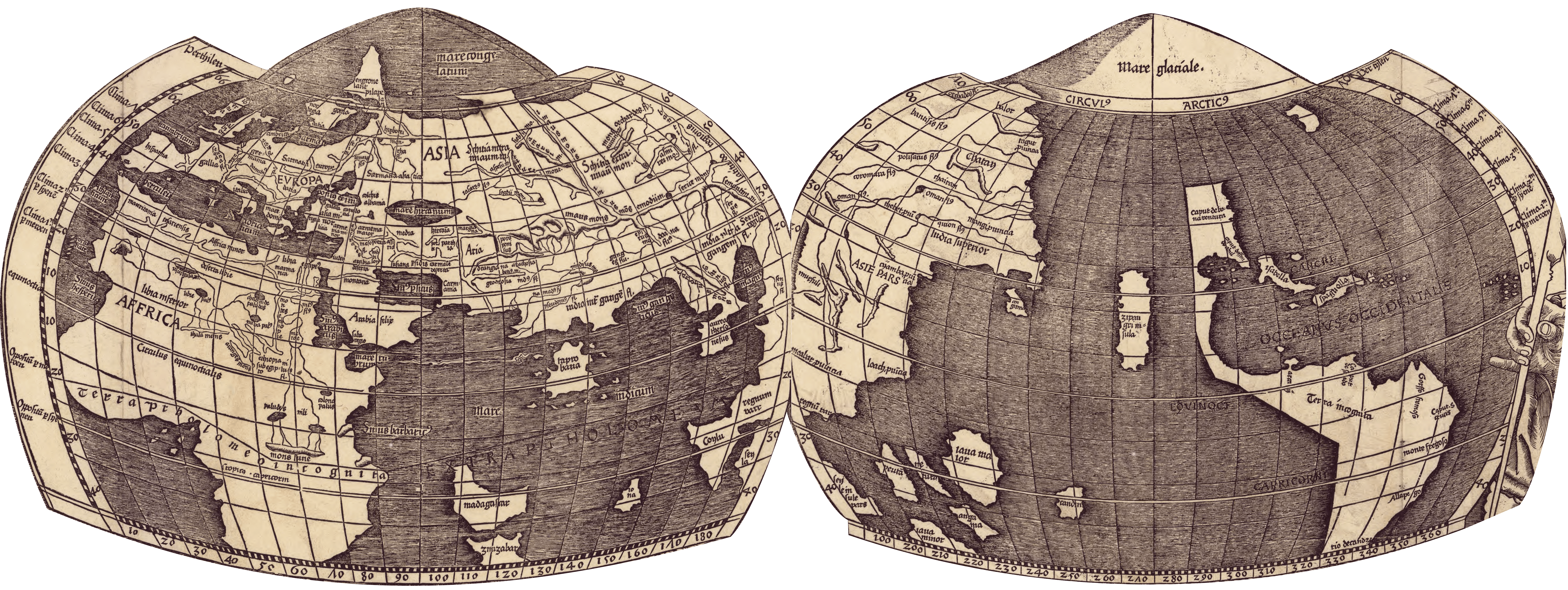
Waldseemüller’s large map of the world has two smaller hemispheric maps at the top (see Fig. 2.2). A portrait of Claudius Ptolemy appears next to the Eastern Hemisphere, while a portrait of Amerigo Vespucci appears next to the Western Hemisphere. Ptolemy’s sphere (see above, left) shows the Greek oikoumene–the world that he had mapped, except that Waldseemüller shows the limits of Ptolemy’s knowledge with a line that bisects Africa. Under it Waldseemüller inserted “Terra Ptholomeo Incognita,” (Land Unknown to Ptolemy). This line continues into the Indian Ocean, where a black text in capitals states: “EXTRA PTHOLOMEUM” (Outside Ptolemy). The Western Hemisphere (see above, right) presents the knowledge mapped by modern navigators, symbolized by Vespucci. The sphere is dominated by a vast ocean labeled as Oceanus Occidentalis (Western Ocean) with the newly discovered lands that we know today as North, Central, and South America in the center right and Asia on the left. Vespucci’s little finger points into the ocean on the far right.
Waldseemüller’s Universalis Cosmographia is on permanent display in the Jefferson Building at the Library of Congress. For access to a zoomable, high resolution digital copy, click here.