Fig. 4.2. Waldseemüller’s Fourth Part of the World on Three Maps, 1507
Details from Martin Waldseemüller, Universalis Cosmographia, Geography and Map Division, Library of Congress, Washington, DC (left and right) and recreated globe from Martin Waldseemüller, The 1507 globular map of the world, courtesy of the James Ford Bell Library, University of Minnesota, Minneapolis (center).
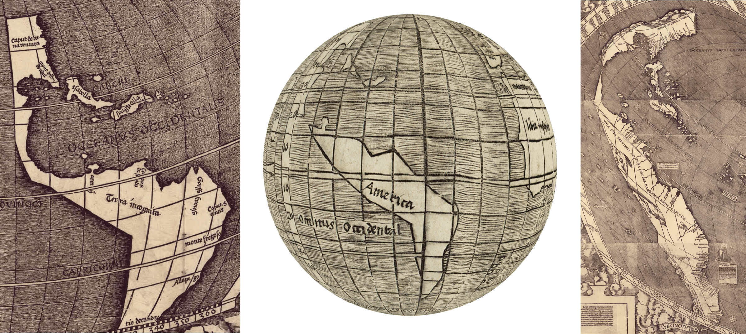
Waldseemuller mapped the Americas three times in 1507: on the huge Universalis Cosmographia, on the Western Hemisphere at the top of the Universalis Cosmographia, and on the globe. This figure compares how he presented the Americas on each. Waldseemüller placed the fewest number of labels on the globe, just “America” for the land and “Oceanus Occidental” (Western Ocean) for the water (see above, center). On the Western Hemisphere map, Waldseemüller has two labels for North America, which appears to be the Yucatan Peninsula: “Caput de bona ventura” (Cape of Good Luck) and Caput dos fins de abril (Cape of the End of April). Prominent are the islands of Cuba (labeled “Isabella”) and Hispaniola (labeled “Spagnolla”). Over South America, he inscribed “Terra incognita” (unknown land) and provided seven place names that refer to geographic features, such as capes, rivers, and a mountain (see above, left). On the huge world map (see above, right), there are considerably more labels, but the most prominent texts state that the two land masses–in the North “Parias” and in the South “America”–are “ultra incognita” (very unknown). There is little characterization of the landscape, except for mountain ranges and rivers. A bird is the only illustration. Along the eastern coastline of South America, Waldseemüller placed toponyms taken from charts, and he inserted Spanish and Portuguese flags to mark places discovered. In a text box, next to a ship, he describes the discovery of Brazil in 1500 by Pedro Álvares Cabral.