Martellus’ Atlantic Chart/Map
Henricus Martellus, Oceanus Occidentalis in Insularium Illustratum (1495), British Library, pages 70 verso and 71 recto, available through the Pelagios Project: https://doi.org/10.21250/pel02.
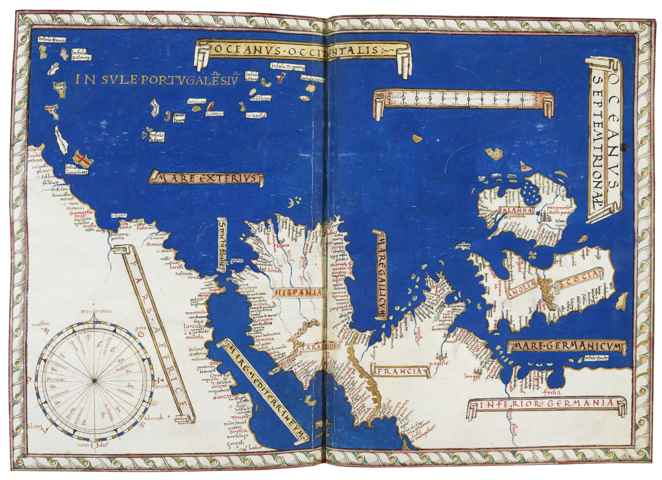
In the same edition of the Insularium Illustratum where Martellus introduced his striking mappamundi that challenged Ptolemy’s view of Africa and the Indian Ocean (see fig. 1.7), there is another very unusual map, titled the Oceanus Occidentalis (Western Ocean). The map, which emphasizes North Africa, the Iberian Peninsula, France, Germany, England, Scotland, and Ireland, has a striking contrast between the white mainlands and the deep blue waters of the Atlantic. The chart of the Atlantic accompanies two other charts in this edition of the Insularium Illustratum. One chart is of the Mediterranean, the other of the Black Sea. All three are rendered to match the other maps of the Insularium Illustratum. Martellus paints the water the same rich deep shade of blue and encloses each in a similar frame. By including these maps in this edition, Martellus emphasizes the importance of charts, just as his mappamundi similarly stresses the significance of charts for mapping the coast of Africa unknown to Ptolemy.
To create Oceanus Occidentalis (Western Ocean), Martellus clearly copied a chart. Over northwest Africa, Martellus has drawn a technical compass rose, and over the ocean, a scale. Martellus inserted toponyms for all coastlines, except in the far north of Europe. However, Martellus’ Oceanus Occidentalis does not present the Atlantic in the same way that a chartmaker would have. There are no rhumb lines, for example, and the diagram of the compass does not enable navigation. Martellus makes a mistake that no chartmaker would make: North (tramontana) on the compass diagram points East, and East (levant) points North. Martellus has copied the diagram of the compass but he has inserted it incorrectly into the map.
Toponyms (place names) were the bread and butter of a chartmaker’s workshop, and Martellus entered them, but not as a chartmaker would have. He does begin using the chartmaker’s way of writing them–by writing the toponyms at right angles to the coastline, the first letter along the shoreline on the land side. Martellus begins this way in the Mediterranean, with Montpelier, and he continues to enter the toponyms along the Atlantic coastline in this way. However, when it came time to add the toponyms to the coast of west Africa, he inserted the toponyms so that the last letter of the label touched the coastline. The result is that the toponyms for Africa are not entered as a chartmaker would have.
The result is a map and not a chart, for the map does not have the navigational potential found in a chart. Nevertheless, Oceanus Occidentalis (Western Ocean) illustrates Martellus’ view of the importance of chartmakers and their skill with mapping. Other artists and cosmographers also copied charts, harvesting their information while not fully understanding their construction.