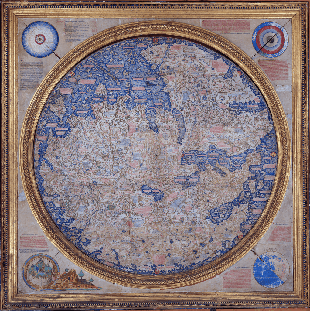
2. Il Mappamondo di Fra Mauro, 1450
Biblioteca Marciana di Venezia.
Fra Mauro created this elaborate mappamundi in 1450 while living as a monk on Murano Island just outside of Venice. Fra Mauro entered a vast amount of knowledge of the world that he had collected, including classical and Biblical sources, the writings of Marco Polo, Ptolemy’s Geography, Arabic texts, maps and charts, and even interviews with Coptic Christian and Muslim informants from East Africa. Fra Mauro retained the T-O structure found on many medieval mappaemundi, but he oriented his map with South at the top. The Garden of Eden can be seen in the lower left border. Although Fra Mauro’s Atlantic Ocean is small in size, he names a section of it “Oceanus Athlanticus” (Atlantic Ocean). Fra Mauro clearly shows that the Atlantic connects with the Indian Ocean at the southern tip of Africa. Fra Mauro made a similar mappamundi for the Portuguese royal court, although it has not survived to the present.
An online site that allows you to explore the map is Fra Mauro’s World Map, which was created by the Galileo Museum in collaboration with the Marciana National Library in Venice as part of the project Scienza, storia, società in Italia. Da Leonardo e Galileo alle “case” dell’innovazione, funded by MIUR from the resources of the Special Integrative Fund for Research (FISR) – CIPE Resolution 78/2017. To access this site, click here.
