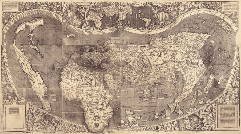
Fig. 2.2. Martin Waldseemüller, Universalis Cosmographia, 1507
Martin Waldseemüller, Universalis Cosmographia, 1507, Geography and Map Division, Library of Congress, Washington, DC.
The Atlantic Ocean is vast and separates Europe and Africa from the newly discovered continents on Waldseemüller’s striking Universalis Cosmographia (1507). Printed on twelve sheets of paper, making the entire surface 128 × 233 cm (approximately 4 × 7 ½ feet), Waldseemüller’s map was a massive undertaking that was intended to be mounted, such as on a wall. The map is most famous today for the name America, which appears for the first time on a map. “America” appears in the large continent to the west of Africa across an ocean. More ocean separates the Americas from Asia. The Indian Ocean dominates the central south.
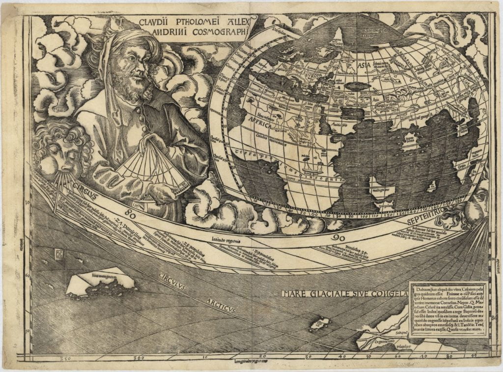
Two inset hemispheric maps appear at the top of the huge map. Ptolemy poses with a quadrant, an instrument used to measure the altitude of celestial bodies, needed for mapping the world. Next to him is the eastern hemisphere with Europe, Africa and Asia, see below.
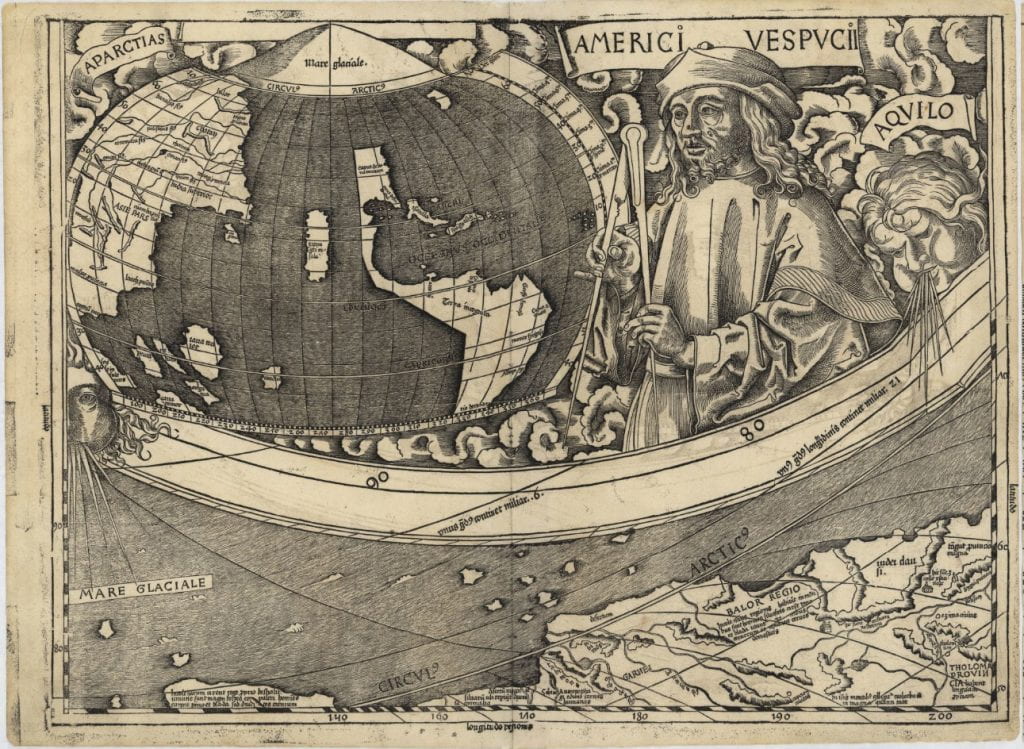
The second hemispheric map on the top of Waldsemüller’s Universalis Cosmographia sits next to Amerigo Vespucci who holds a pair of compass dividers, a tool used by chartmakers and navigators to measure distances on a map. Next to Vespucci is the western hemisphere, in which Waldseemüller presents the newly discovered lands by mariners.
Both of these details from Waldseemüller’s Universalis Cosmographia are individual sheets from the map. Each gives an idea of how the world map was composed from twelve such printed sheets, each pulled separately from a specially cut woodblock. The striking portraits of Ptolemy and Vespucci as well as the careful attention to detail suggests that highly skilled artisans worked on the map.
Waldseemüller’s Universalis Cosmographia is on permanent display in the Jefferson Building at the Library of Congress. For access to a zoomable, high resolution digital copy, click here.


