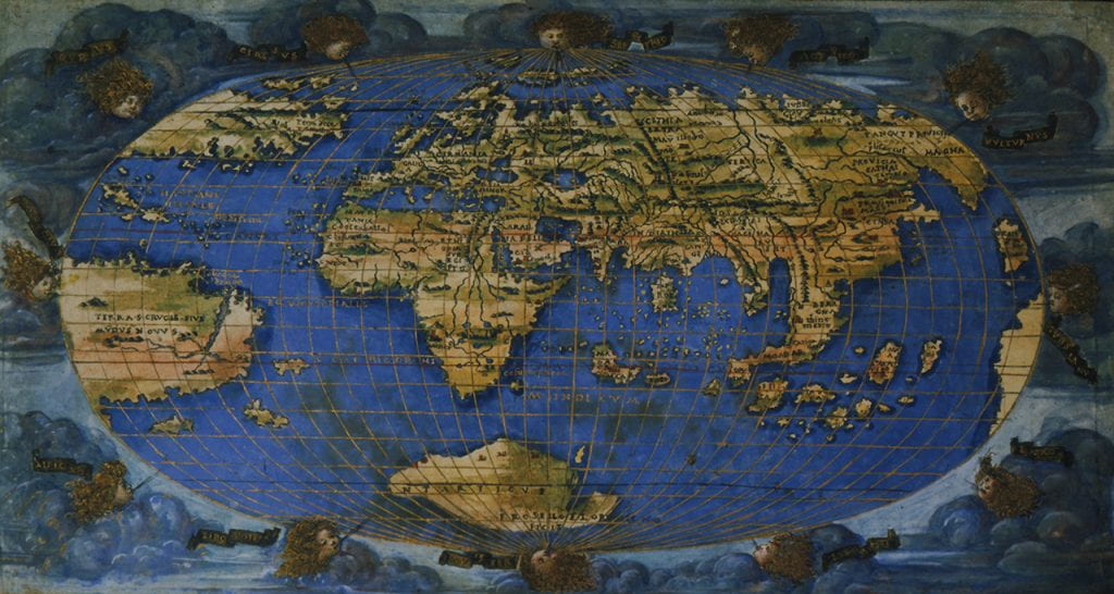
Rosselli’s World Map, 1508
Francesco Rosselli engraved a small world map in 1508 on which the Atlantic is hardly marginal. This map is an excellent example of the fact that although printed, it could also be later finished liberally in color. The copy in the . The blues are rich and thick, whether in the heavens or on the oceans, and the continents are painted in shades of green, yellow, orange, and brown. Twelve windheads emerge out of the clouds, and between them the oval-shaped earth floats in the sky. Oceans dominate the world on Rosselli’s map, and although not named, the Atlantic occupies a prominent part of the globe. The Terra S. Crucis sive Mundus Novus (Land of the Holy Cross or the New World) rises prominently across from Africa, as does a mainland in the North. The Spanish Islands of Cuba and Hispaniola are named. According to the National Maritime Museum, which holds one of the four surviving copies, Rossell created “the earliest extant map to show the world in 360 degrees of longitude and 180 degrees of latitude within an oval projection.” The map measures 420 mm x 370 mm (about 16 1/2 inches by 14 1/2 inches). There are four known copies of this world map: in addition to the
Rosselli died soon after engraving this map and
* Giuseppe Boffito and Attilio Mori, Piante e vedute di Firenze: studio storico topografico cartografico. Florence” 1926 rpt: Roma: Multigrafica, 1973.
