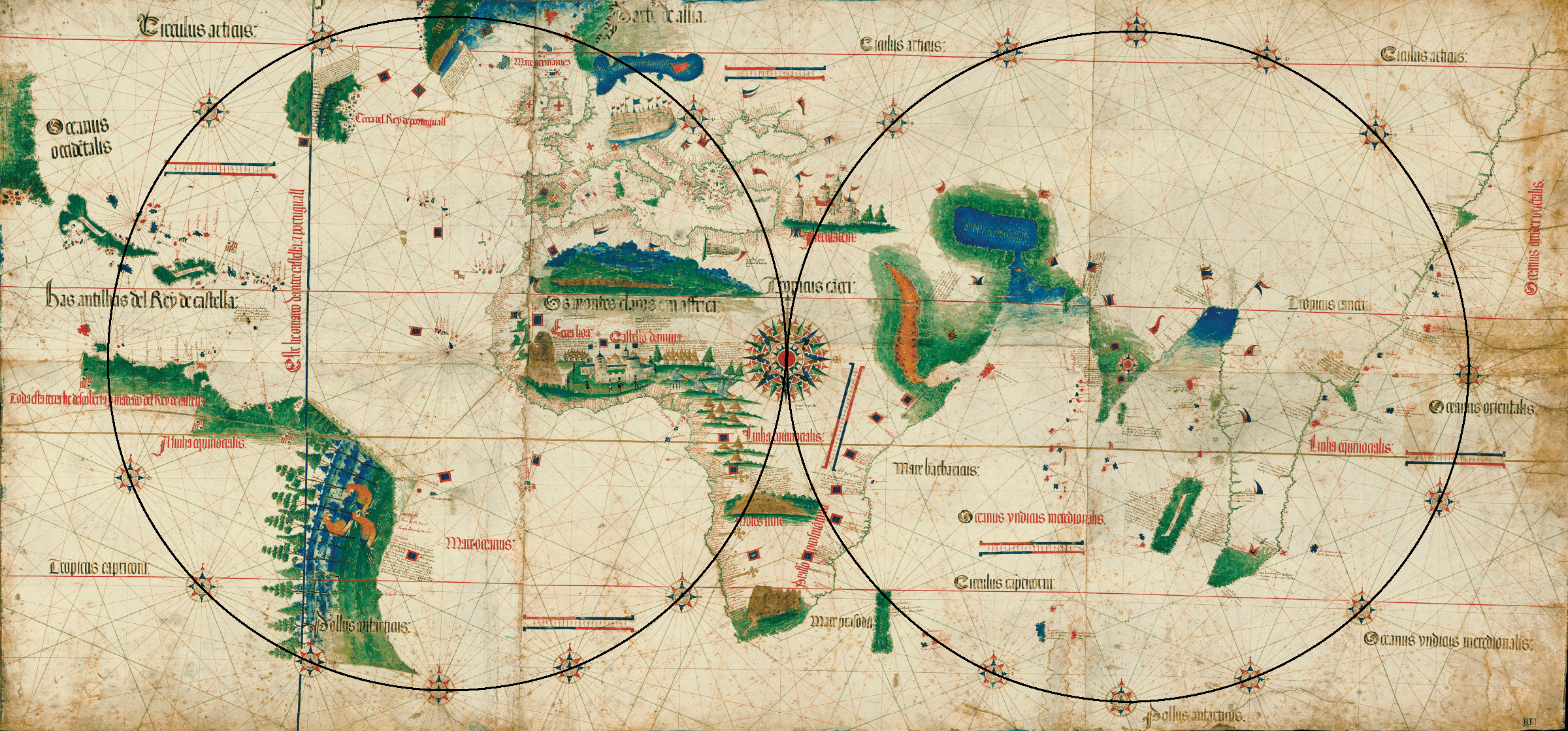
Fig. 3.2. Invisible Circles, Carta del Cantino, 1502
Digitally enhanced Carta del Cantino, Estensi Digital Library, Biblioteca Estense Universitaria, Modena. Permission pending from the Ministry of Cultural Heritage and Activities, Italy.
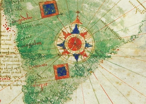
The chartmaker of Carta del Cantino depicts the world in two hemispheres, each framed by an invisible circle–one for the West and one for the East. In the chart’s western hemisphere, the centerpoint of the invisible circle lies in the Atlantic, near the Cape Verde Islands. From the center point, thirty-two lines stretch directly across the Atlantic Ocean to the islands claimed by Spain in the Caribbean, to Europe in the northeast, to the west coast of Africa in the southeast, and to the coast of South America in the southwest. A second invisible circle appears in the east, and its centerpoint lies in India. Over it, the chartmaker placed a sixteen-point compass rose. The rays from this rose stretch north into a huge and empty Asia, west to the Red Sea and the coast of East Africa, south, and east to China and beyond. The world chart has a number of sub-roses, many but not all are decorated. When these two “invisible” circles are drawn, the decorative compass sub-roses fall, like gems, along the circumferences.
Center point of western hemisphere, near the Cape Verde Islands:
Center point of eastern hemisphere in India: